

When the Hemet Police Department needed a better way to analyze crime patterns and response times, they faced a common challenge: too much data locked away in static databases, and not enough meaningful, visual insights to guide decision-making. Manual SQL reports were time-consuming and lacked the geographic context critical for public safety operations. To bridge this gap, Hemet PD turned to Quartic. Through a series of customized GIS dashboards built using Esri technology as their base, Quartic helped the department unlock the power of location-based intelligence, giving officers, analysts, and city leaders a clearer picture of what is happening, where, and when.
The Challenge: Time-Consuming SQL Queries
Before partnering with Quartic, the Hemet Police Department relied on manual SQL queries to extract data from their Computer-Aided Dispatch (CAD) and crime databases. These queries produced text-based, spreadsheet-style outputs, giving staff limited visibility into geographic trends and making it difficult to analyze crime patterns or response times at a glance.
This manual approach also placed a significant operational burden on staff, who needed to build custom queries and reports for different types of analysis. Hemet PD needed a smarter, faster way to view, understand, and act on their crime and call data, without requiring advanced technical skills or heavy maintenance.
The Solution: Interactive GIS Dashboards & ArcGIS Solutions
Quartic deployed a suite of GIS dashboards, using several of Esri’s ArcGIS Solutions for law enforcement as their base. Quartic configured the dashboards and ArcGIS Solutions to precisely meet Hemet PD’s operational needs.

ArcGIS Pro

ArcGIS Online

ArcGIS Dashboards

ArcGIS Solutions

ArcGIS Data Pipelines
Key elements of the solution included:
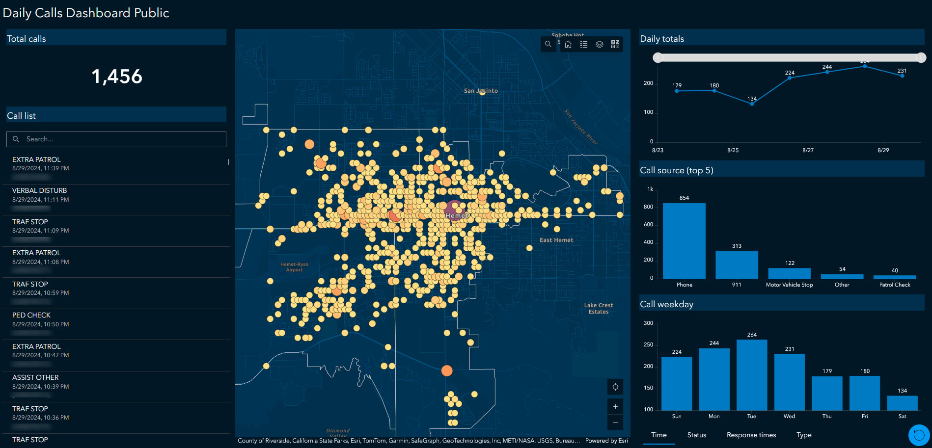
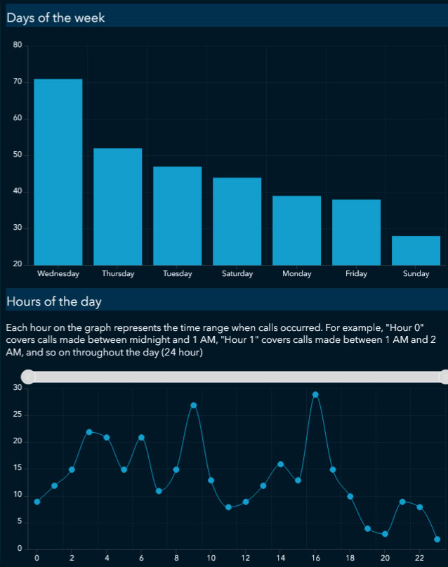
- Crime Analysis Dashboard: Configured for daily updates, providing real-time views of crime data with custom filters and year-to-date graphs.
- Homeless Outreach Dashboard: Specialized tracking tools for monitoring outreach efforts and resource allocation.
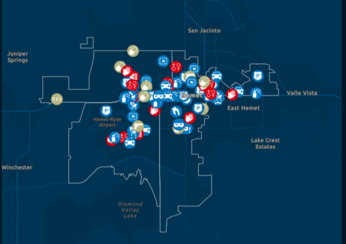
- Anonymized Dashboard: A fully customized version of the Daily Activity Dashboard, featuring anonymized and clustered data to protect sensitive information while enabling city directors and decision-makers to access operational insights safely.
- Crime Problem Management ArcGIS Solution: A custom configured ArcGIS Solution used to monitor and visualize theft-related incidents by location and time.
- Automated Data Pipeline: All dashboards and ArcGIS Solutions were set up to update automatically, minimizing the need for ongoing manual input or technical upkeep.
By integrating CAD and crime data into GIS, Quartic unlocked geographic insights that Hemet PD had never been able to access before, such as identifying hotspots for specific types of crimes or analyzing areas with slower response times.
The Results: Adding Geographic Context to Police Data
Today, the Hemet Police Department staff have powerful, easy-to-use dashboards that allow them to:
- Instantly visualize and analyze crime and call data geographically.
- Prioritize policing efforts based on real-time, location-based intelligence.
- Share sensitive data safely with city leadership, without compromising private information.
- Make faster, better-informed decisions that support community safety.
The transition from static spreadsheets to dynamic, interactive maps has not only improved operational efficiency but has also laid the foundation for expanding GIS capabilities across other city initiatives.
Quartic’s customer-focused approach ensured that the Hemet PD’s system was tailored, self-sufficient, and built to evolve alongside the city’s needs, delivering lasting value without adding extra burden to internal teams.
“Quartic’s strength lies in transforming a client’s high-level GIS requirements into a fully functional and field ready solution. We managed every step – from data loading and automation to custom configuration – in order to deliver a tailored system the client can immediately put to use.”
Alexandre Bontemps – Senior GIS Analyst