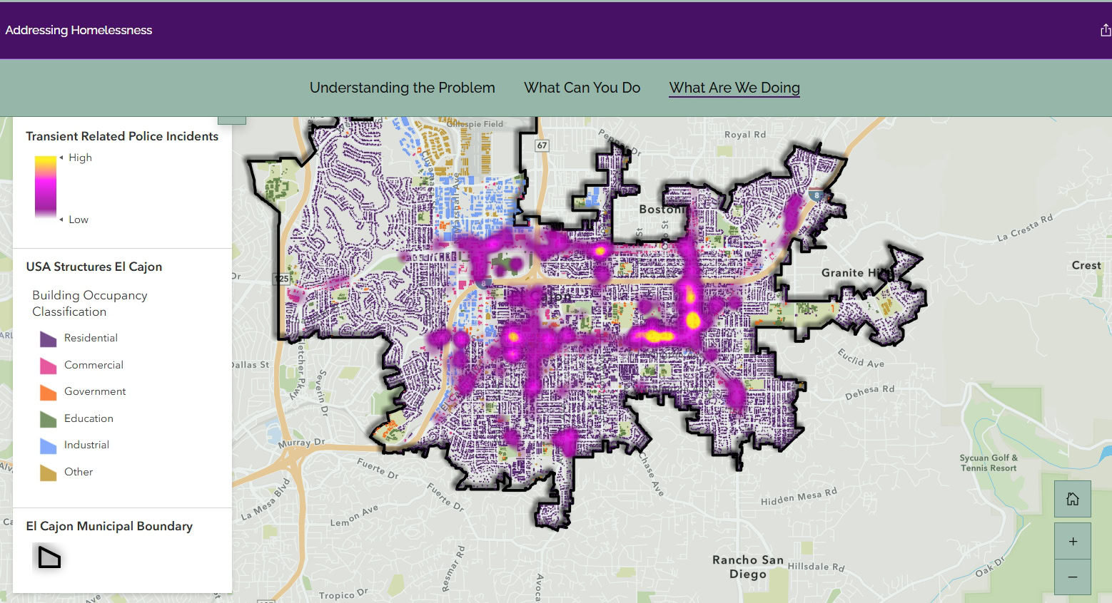
Automation Provides Daily Homelessness Data for City of El Cajon
The City of El Cajon wanted to communicate homelessness data to the public in a clear, visual format. It needed a reliable process for moving...


The City of El Cajon wanted to communicate homelessness data to the public in a clear, visual format. It needed a reliable process for moving...

San Diego Community Power launched its Solar Battery Savings incentive program and needed a way to identify and visualize qualifying residences. Quartic’s GIS-driven solution supports...
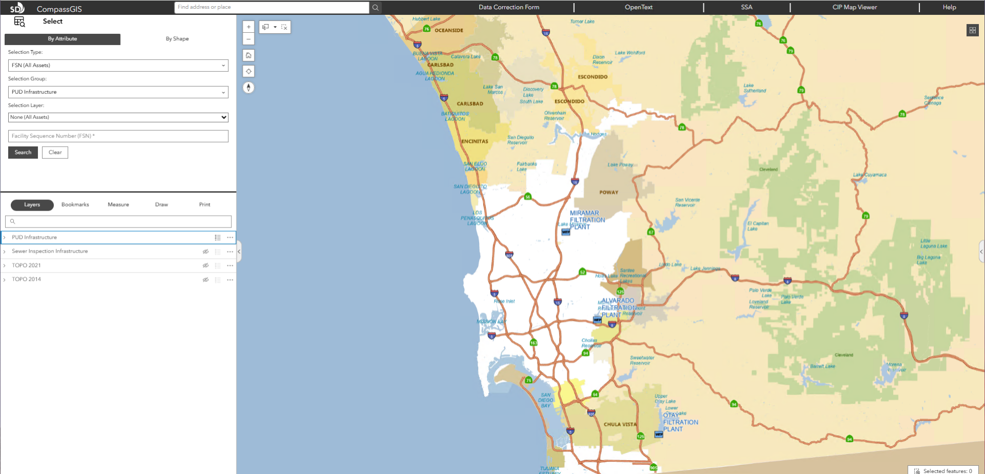
The City of San Diego’s Public Utilities Department (PUD) serves more than 2.3 million wastewater customers and provides drinking water to 1.4 million residents. The department...

Long Beach Transit (LBT) keeps southeastern Los Angeles County and northwestern Orange County moving, serving more than 18 million riders each year. Covering over 100 square miles across 14 cities,...

Located on the southern coast of San Francisco Bay, Santa Clara County is home to Silicon Valley and is the sixth most populous county in California. The Santa Clara...

As organizations expand their GIS environments and rely more heavily on web maps, services, field mobility, and integrated systems, performance challenges can surface in ways that...

The City of Encinitas, located on northern coast in San Diego County, serves a population of approximately 62,000. The City’s GIS department saw an opportunity...

Vallecitos Water District faced a common but pressing challenge: their legacy GIS system, built on Esri’s soon-to-be-retired Geometric Network model, couldn’t keep up with the...

When the Hemet Police Department needed a better way to analyze crime patterns and response times, they faced a common challenge: too much data locked...

The County’s Emergency Operations Center (EOC) used its mapping software and technology to respond to Tropical Storm Hillary this January. While the storm significantly impacted...