

The City of El Cajon, the sixth largest city in San Diego County, serves approximately 104,000 residents. It has made addressing homelessness a key priority. As part of this effort, the City sought to improve transparency and provide residents with a clearer understanding of homelessness trends and response efforts.
Challenge
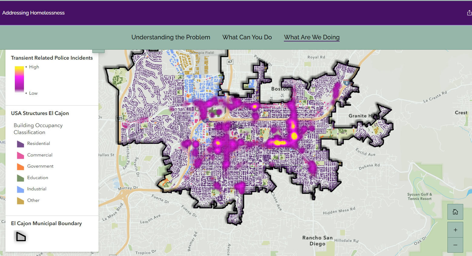
The City wanted to communicate homelessness data to the public in a clear, visual format via an ArcGIS Storymap with embedded dashboards. It needed a reliable process for moving daily data from its police Computer-Aided Dispatch (CAD) into ArcGIS Online. Without automation, keeping public-facing information current would require ongoing manual effort.
Technical Solution
Quartic developed an automated workflow using Python to pull daily transient-related call data directly from the CAD system and publish it to ArcGIS Online. This process powers a time-enabled web map, heat map, and interactive dashboard embedded within the City’s ArcGIS StoryMap, allowing users to explore trends such as transient disturbances and illegal lodging over time.
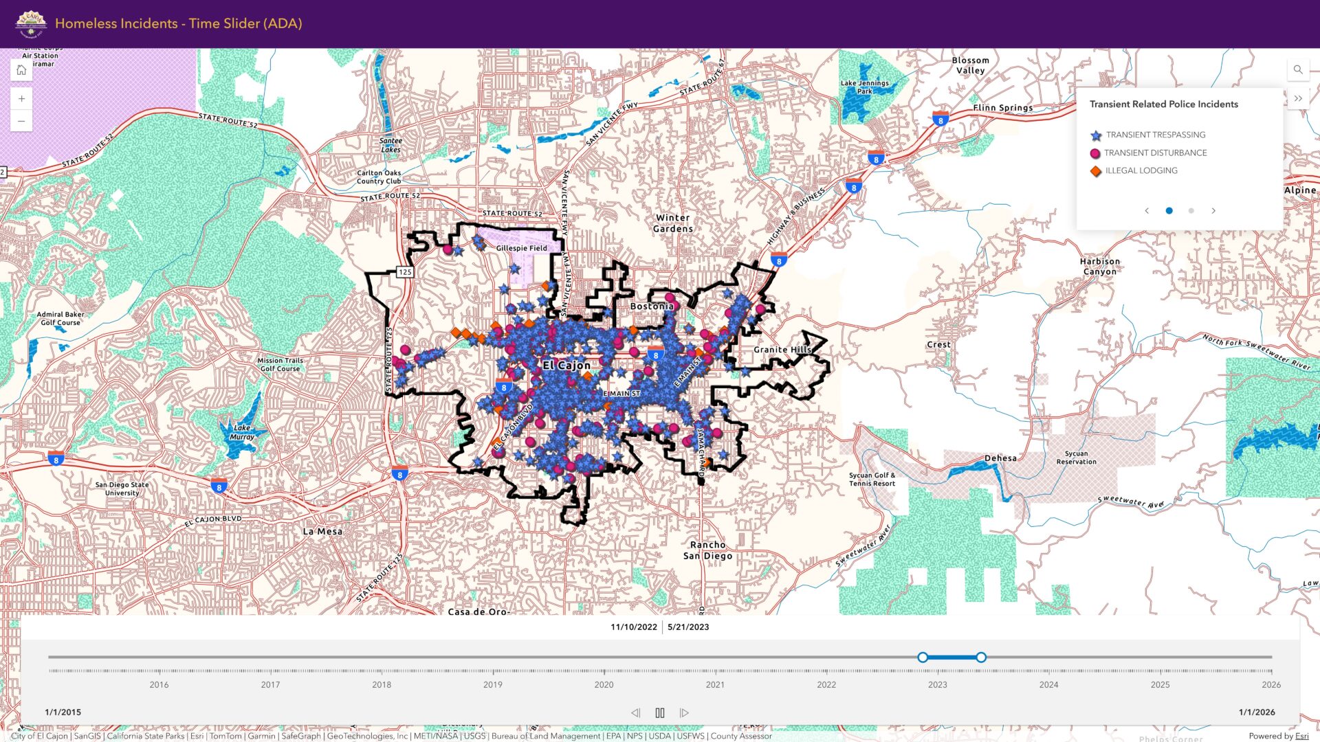
To ensure data accuracy, Quartic implemented local time conversion within the script, an important step to ensure accurate representation of incident time and usage of the app’s time slider.
The solution also provides email notifications in case of missing source data or any problems uploading data to ArcGIS Online.
Software/Technology

ArcGIS Online

ArcGIS API for Python

ArcGIS Dashboards

ArcGIS Storymaps
Results
The City of El Cajon’s Addressing Homelessness StoryMap now provides residents with transparent, continuously updated data on the City’s interactions with the homeless population.
Automation ensures that new information is integrated daily, enabling a near real-time view of trends while reducing the need for manual data processing. This has improved both public communication and internal visibility into homelessness-related activity.
The StoryMap has been featured in City Council meetings and local news coverage, expanding its reach and impact within the community.
“Quartic’s expertise in data management and scripting, along with their quick turnaround time, allowed us to achieve our goal.”
-Emily Orsborn, GIS analyst for the City of El Cajon
