


As California’s second most-populated county, San Diego is home to millions of residents who must be prepared for a wide range of threats and hazards including wildfires, flooding, tsunamis, and extreme heat. With its size, population density, and diverse landscapes, San Diego County residents face a higher-than-average risk of natural disasters compared to many other regions. In these complex situations, minutes matter in emergencies, and these emergency incidents often require rapid public notifications to communicate evacuation areas, road closures, and hazard locations.
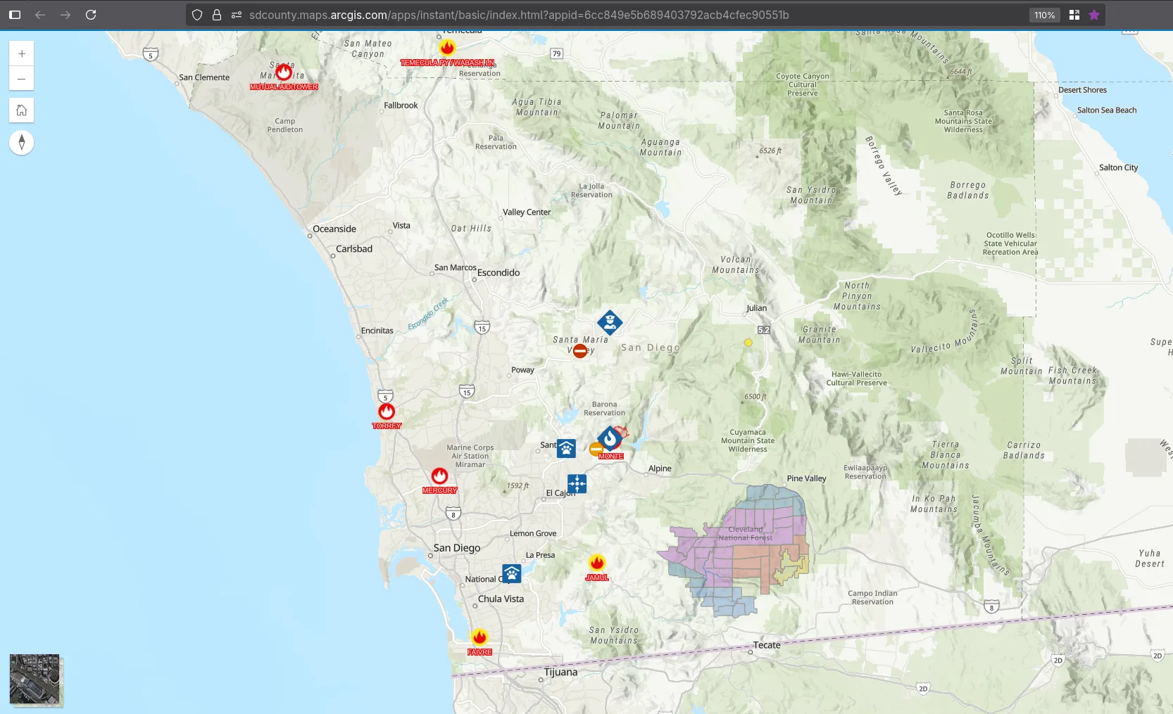
The County of San Diego must share this information with a large and dynamic population, including 3.2 million residents, surrounding communities, and visitors. To keep the public informed, the County’s Office of Emergency Services (OES) maintains the Emergency Map on its www.AlertSanDiego.org website, an interactive emergency public information map providing residents with quick access to vital, location-based information.
The Challenge: A Costly, Manual System
The previous emergency map, a custom 3rd party solution, was functional, but had several limitations. Updates to the map required OES staff coordination with the County’s IT vendor for set-up and programming, and any changes to the application were time-consuming to implement, all of which compounded costs.
The process also required too much OES staff involvement. When an evacuation zone was identified, OES staff had to login to the mapping platform and initiate a real-time data refresh in order to refresh the public map, a manual process which could impact the flow of information during fast-moving incidents.
“We wanted something more flexible and automated,” said Michael Robles, GIS Coordinator at OES. “Any change to the system configuration and settings required time, planning, and work with our IT vendor. It worked, but it was time consuming and more expensive to update.”
OES also needed a solution that could scale instantly during major events. Large-scale emergencies, along with regional interest and visitor traffic, often create viral demand for access to emergency information. During the COVID-19 pandemic, Robles observed how Esri’s ArcGIS Online and ArcGIS Velocity platforms successfully powered real-time dashboards under intense public traffic. This demonstrated the scalability and performance OES needed and inspired the transition to an Esri-based solution aligned with the County’s enterprise GIS standards.
The Solution: Real-Time, Automated, and Ready to Scale
Esri-Gold Tier partner Quartic collaborated with OES to design and implement a modern, future-ready emergency mapping solution that met all technical and operational requirements.
“Quartic’s professionalism, passion, and partnership really set them apart.
Michael Robles, GIS Coordinator at OES
They wanted to make this map a success as much as we did.”
Now, when a local first responder agency issues evacuation notifications, updated data appears on the County’s website within minutes. Using ArcGIS Velocity, the system automatically ingests evacuation zone status data, hazard info, and related incident details from the County’s evacuation management platform, Genasys EVAC, and streams it to the public-facing map in real-time.
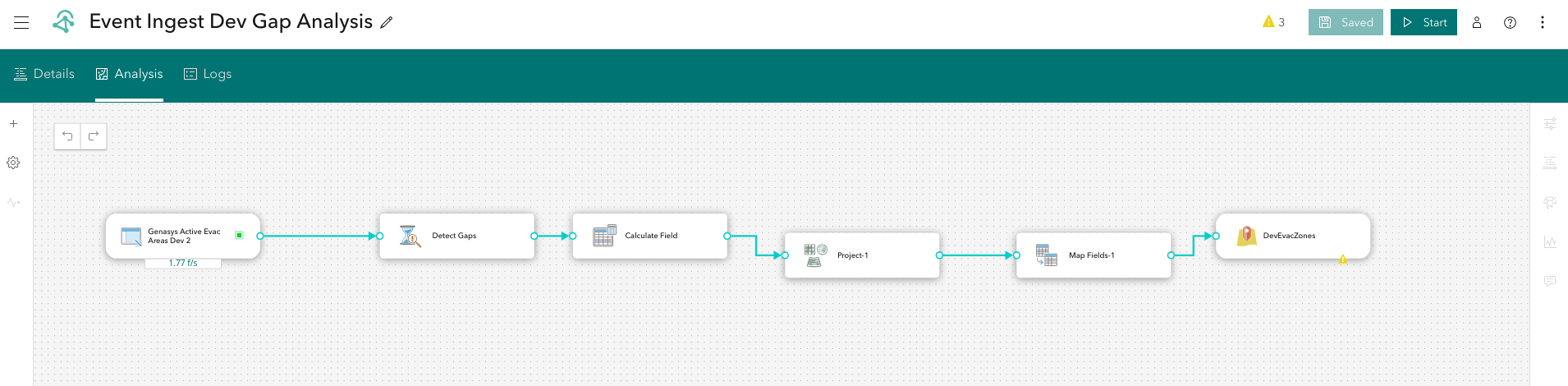
“Having real-time evacuation zone data is critical,” said Robles. “With this new map, we can be confident the data is current and available to the public.”
Recognizing that major incidents can quickly attract widespread public attention, Quartic designed the architecture around modern, scalable technologies and proven best practices, enabling the map to reliably handle tens of thousands of requests per hour during periods of peak demand.
Automation has also eliminated manual publishing bottlenecks and reduced staff workload.
“It’s relieved a huge burden on staff,” Robles said. “When zone statuses are updated, the information now flows automatically to the public map. It’s no longer on one person to push those updates through.”
Software/Technology

ArcGIS Velocity

ArcGIS Online

Genasys
The Results: Faster Updates, Reduced Burden, Better Public Access
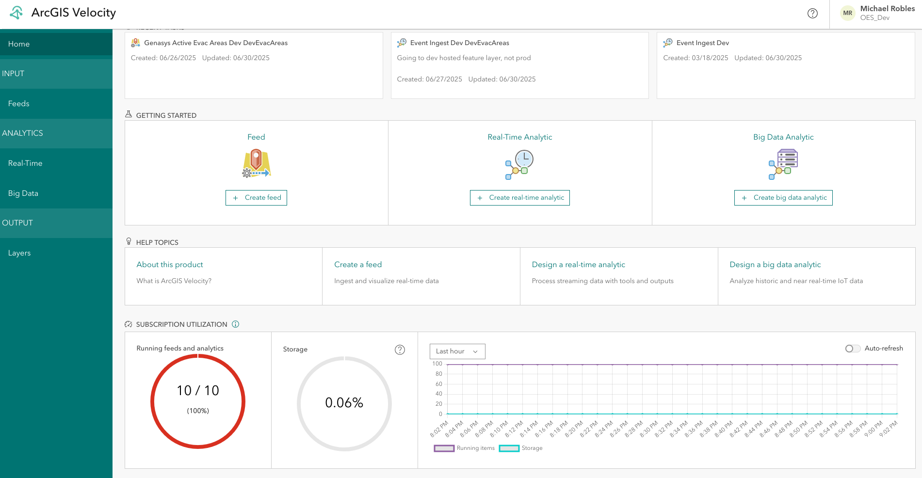
The new emergency map loads faster, scales seamlessly under high demand, and delivers trusted, real-time information to the public. The project also marked the County’s first implementation of ArcGIS Velocity, paving the way for future real-time data integrations across departments.
“We have a competitive edge. I’ve seen our map update faster than other well-known public-facing third party tools. We are cutting edge, and that means better service for the public.”
Michael Robles, GIS Coordinator at OES
Just days after going live, the Emergency Map faced its first real-world tests and passed with flying colors. On August 6 2025, it helped the County communicate National Weather Service heat advisories, keeping residents informed of safety risks. Only 48 hours later, the map played a critical role during the Roadrunner Fire, delivering real-time evacuation updates directly from the regional Genasys Protect emergency system.
The new Emergency Map is also connected to OES’ Alert San Diego smartphone app.
“When people receive an alert on their phones, they can go straight to our website and understand the situation right away,” said Robles.